Nature-orientated and sustainable grassland management in Saxony-Anhalt to promote the Natura 2000 habitat types 6210(*), 6440 and 6510 as well as Dactylorhiza majalis as a species of national response
Tasks
Tasks
- Testing and review of the effects of different measures (combinations) of mowing and fertilization on species composition, vegetation structure, soil nutrients and crop usability as well as appreciation by target species establishment on two experimental plots of habitat types 6440 (Cnidion floodplain meadows) and 6510 (Lowland meadows).
- Evaluation of selected measures from the agri-environmental program „Freiwillige Naturschutzleistungen“ on grassland in Saxony-Anhalt
- Status Quo analysis of vegetation composition, feed value and soil chemical parameters of selected meadows of LRT 6510 in the Biosphere Reserve “Karstlandschaft Südharz”
- Updating the guideline as well as the grassland site groups and management recommendations for grassland habitat types 6440, 6510 and 6520 in Saxony-Anhalt
- Updating of the internet information platform for "grassland management" and for the database "grassland experiment plots"
Management experiment plots
Management experiment plots
In two experimental plots existing since 2010, the effects of different management factors, such as different fertilizer types, cutting dates and frequencies, treatment by rolling and seeding of target species on species composition, vegetation structure, condition, yield, feed value and soil chemical properties are analyzed and evaluated.
Investigations take place on a natural habitat type 6510 in the Wulfener Bruch near Köthen and on a Cnidion dubii meadow near Dessau. Both sites belong to the Biosphere Reserve “Mittelelbe”.
The Wulfener Bruch, a flat area with high groundwater levels, is situated between Köthen and Aken (Saxony-Anhalt). Parts of the area are included in the UNESCO Biosphere Reserve „Mittelelbe“. The landscape is characterized by agriculture, particularly meadows and pastures. Arrhenatheretum elatioris (natural habitat type 6510) covers most parts of the investigation area, which is located at the margin of the nature reserve „Wulfener Bruchwiesen“, the Site of Community Interest „Diebziger Busch und Wulfener Bruchwiesen“, and the Special Protected Area „Wulfener Bruch und Teichgebiet Osternienburg“. Large areas of the wet meadows were drained at the beginning of the 19th century. Over the centuries, the study site developed into a species-poor version of the Arrhenatheretum elatioris mainly through fertilization and, especially in the last few years, through insufficient mowing. Prior to the project, start funds were applied for the meadow including the study site. As a result, the first cutting was conducted after June 15th. A second voluntary cutting was not economical and, therefore, not realized.

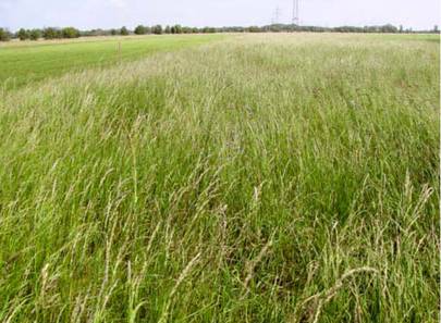
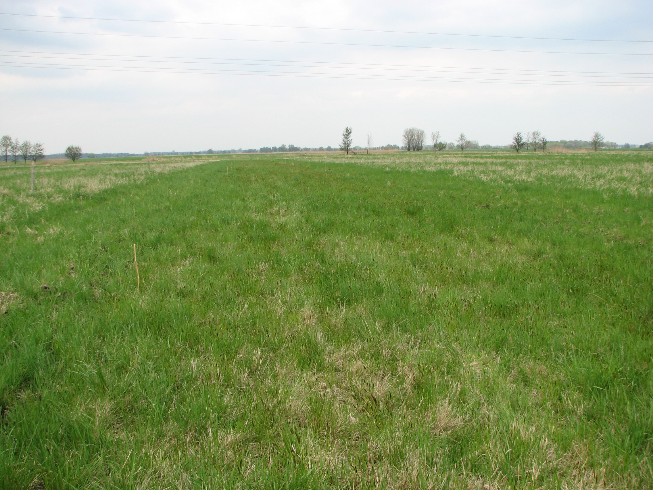
Experimental plot in the Wulfener Bruch in the first trial year (June 2010). (photo: Jessica J. Arland-Kommraus) 
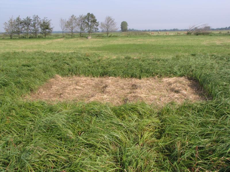
Experimental plot cut manually (5x5 m) in the Wulfener Bruch in September 2011. (photo: Sandra Dullau) The “Fischerhüttenwiesen” near Dessau are located east of Waldersee and in the north of the main road to Vockerode and are surrounded by the lake Löbben, a backwater. They are located in the Biosphere Reserve "Mittelelbe" and the Site of Community Interest "Dessau-Wörlitzer Elbauen". The experimental site is an area of alternately wet grassland (approx. 67 ha) with constant presence of characteristic species (eg Cnidium dubium, Galium boreale, Sanguisorba officinalis). In the northern part it corresponds to the habitat type 6440 and it is equipped with high species richness and has a high proportion of habitat types and characterizing species. Phytosociological the area is assigned to the Sanguisorbo officinalis-Silaetum Silai Klapp 1951. The area is regularly flooded at least once a year.

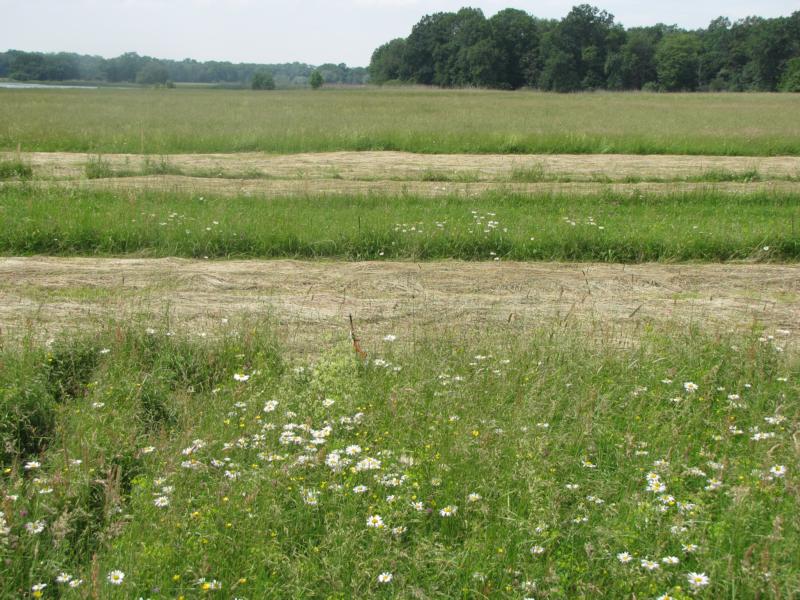
Mowed strip, not yet removed hay cover on the experimental site Fischerhüttenwiesen in the first year of the trial (June 2010). (photo: Jessica J. Arland-Kommraus) 
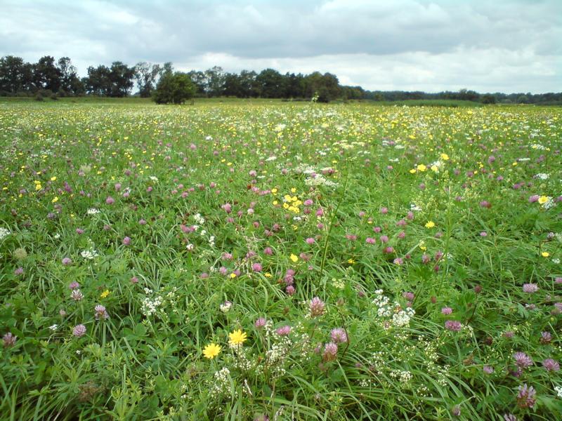
Flowering aspect of the Fischerhüttenwiesen in July 2011 with Trifolium pratense, Galium mollugo, Galium boreale, Daucus carota, Leontodon autumnalis and Ranunculus acris. (photo: Katja Eis) Experimental management variants
Experimental site Wulfener Bruch Experimental site Fischerhüttenwiesen bei Dessau Cutting: once a year (15.06.), twice 01.-15.05. / 01.-30.08., three times 01.-15.05. / 01.-15.07. / from 01.09.
fertilizing: control, 60 kg N/ha, 120 kg N/ha each with and without P-fertilizer depending on the output
Rolling
Seeding of target species Cutting: twice a year (01.06. / 15.08., (twice 15.06. / 15.08.), three times (silage-maturity), three times (pasture-maturity, / 01.07. / 01.09.)
fertilizing: control, PK-output, 60 kg N/ha, 60 kg N/ha + PK-output, 100 kg N/ha + PK-output, 120 kg N/ha + PK-output
Rolling

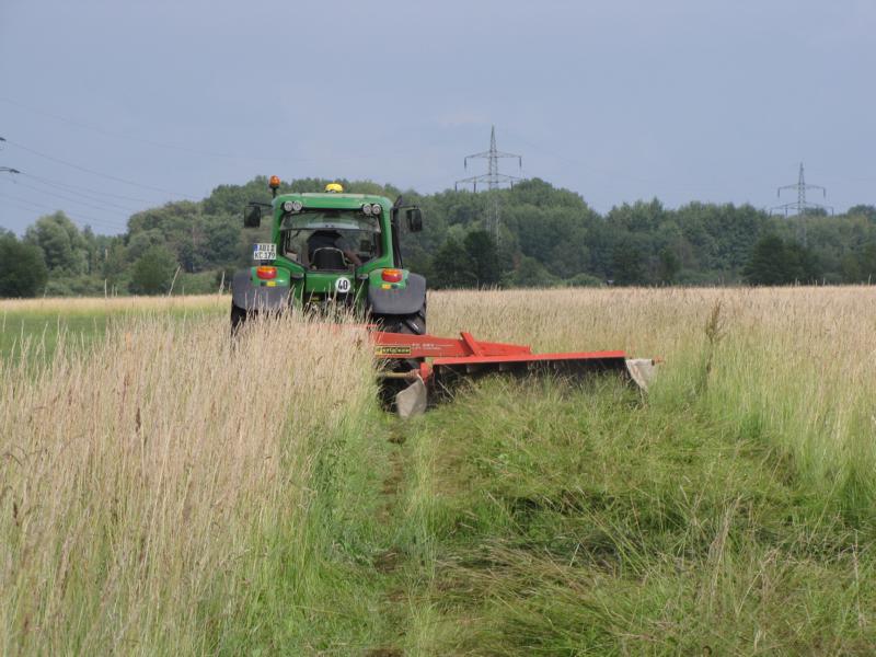
Mowing of the stripe cut once a year in the Wulfener Bruch in June 2011. (photo: Jessica J. Arland-Kommraus) 
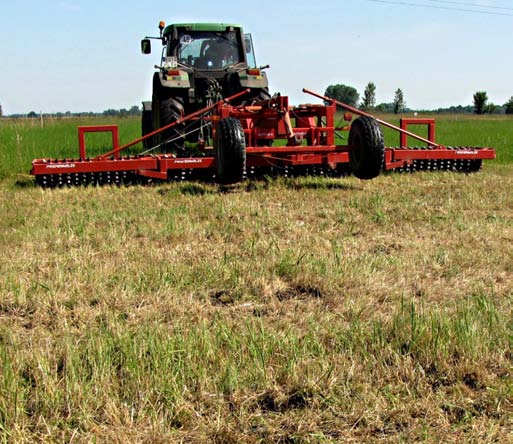
Treatment of the experiment plots by rolling. Species which are sensitive to rolling are investigated. (photo: Jessica J. Arland-Kommraus) 
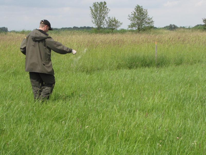
Manual fertilizing on experiment plots of 5m x 5m. (photo: Sandra Dullau) In order to observe the effect of the various management factors, soil chemistry, floristic species composition, vegetation structure, yield shares and forage quality will be analysed for a period of 6 years (2010-2015).

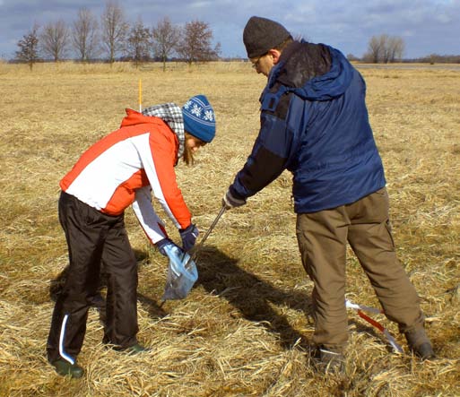
Taking soil samples for chemical analysis of the nutrient content in the soil in March 2010. (Photo: Sandra Dullau) 
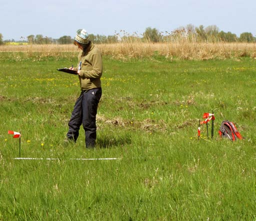
Vegetation surveys in May 2010. (Photo: Jessica J. Arland-Kommraus) 
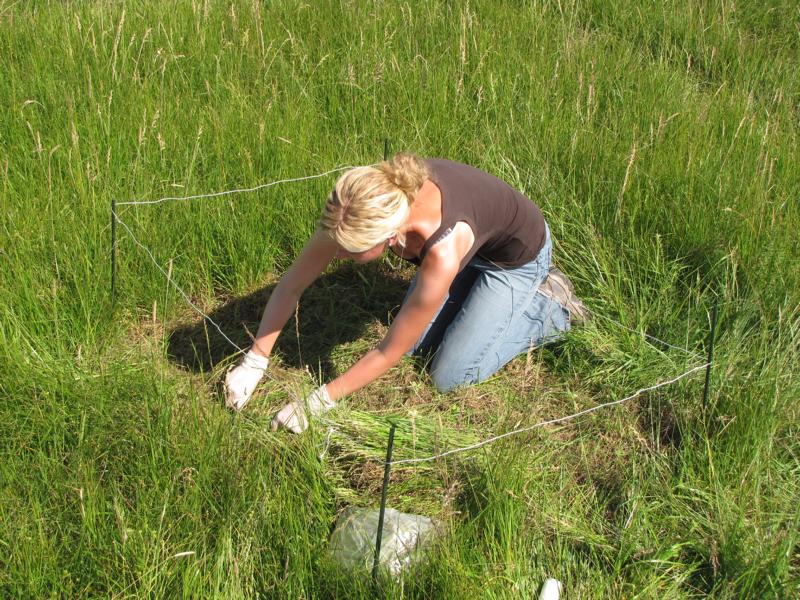
Cutting out a forage sample on 1m². (Photo: Jessica J. Arland-Kommraus) Improvement of grassland by introducing target species (Wulfener Bruch)
Improvement of grassland by introducing target species (Wulfener Bruch)
In 2011, target species were introduced in strips at the block experiment in the Wulfener Bruch (see also subsection "Management experiments"). On the one hand, this leads to an upgrading of the species-poor grassland area. On the other hand, it enables the investigation of the establishment success of the target species under different management methods (mowing frequency, fertilization, rolling). As a result, recommendations can be made as to the extent to which the target species strips can be subjected to the same management as the entire remaining grassland area after sowing.
In 2010, 16 target species strips with an area of 6 x 150 m were created on the area that is assigned to habitat type 6510 (lean lowland hay meadows) with a transition to LRT 6440 (burning umbel floodplain meadows). These were first plowed in late summer and then cultivated. Then the strips lay fallow for 1 year to be rubbed again in summer 2011 to prepare the seedbed. In September, which is the most suitable sowing time for the continental regions of Central Germany, 6 types of grass and 22 herbs were sown. The grassland is a very nutrient-rich area (mean values of the sample areas: pH: 6.48 (± 0.68), N total% 0.74 (± 0.30), P mg / 100 g soil 11.31 (± 7.01), K mg / 100 g soil 20.90 (± 5.58).

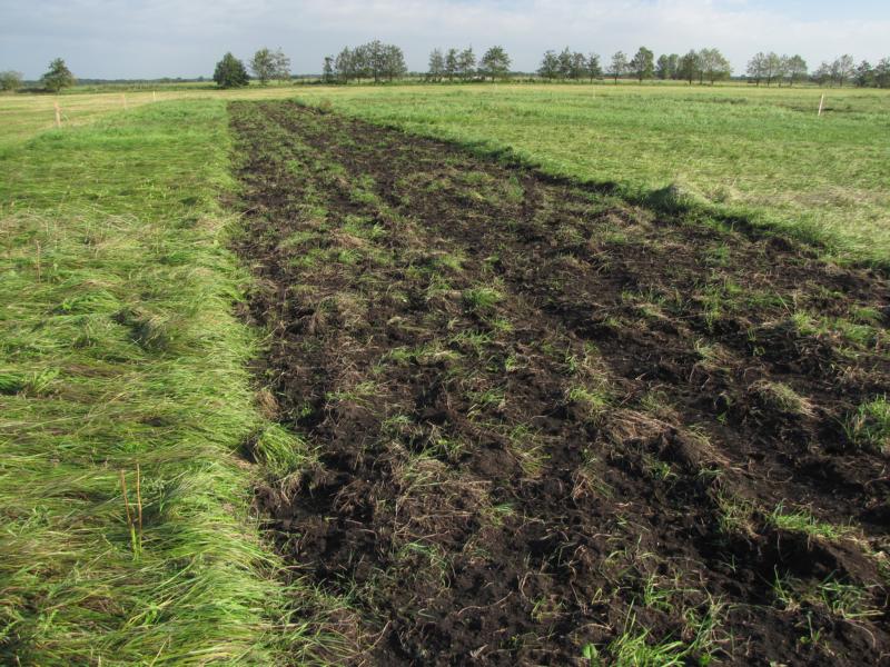
Grubbed stripe (6 x150 m) of sown target species in the Wulfener Bruch. (photo: Sandra Dullau) 
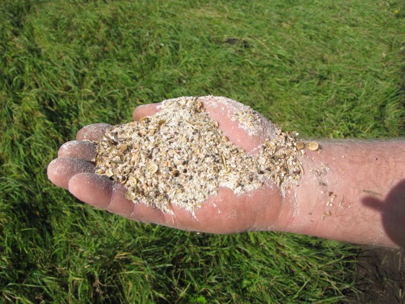
Seeds of target species mixed with groats. (photo: Sandra Dullau) 
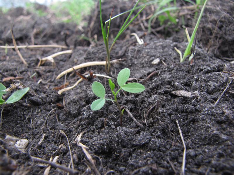
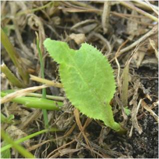
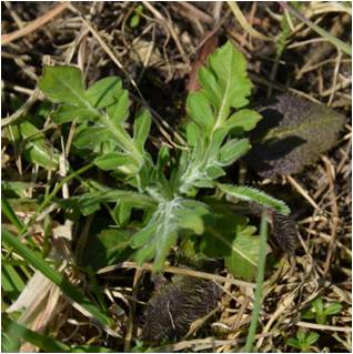
Lathyrus pratensis-seedling in late autumn 2011. (photo: Jessica J. Arland-Kommraus) As expected, mass populations of therophytes (including Capsella bursa-pastoris, Veronica arvensis) or perennial species such as Trifolium hybridum and Cirsium arvense and numerous grasses from the rhizomes still remaining in the soil established themselves on the target species strips in the first year after implementation. e.g. Alopecurus pratensis, Holcus lanatus). After regular pruning in accordance with the experimental setup (one to three furrows) and subsequent maintenance pruning in autumn, the areas in spring 2013 presented themselves with significantly more herbs than the comparable control areas without sowing.

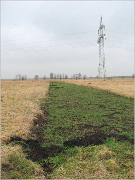
Strip of target species in March 2012 with sparse vegetation, some of the rows of seeds are still recognizable and mainly grasses are growing up. (Photo: Henriette John) 
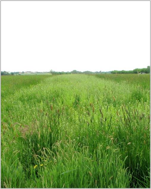
The target species strips are now densely overgrown in the early summer of 2012 and stand out from the surrounding area with a significantly lighter color. The reason for this is the dominance of annual, white-flowering species such as shepherd's purse (Capsella bursa-pastoris) and Acker-Hellerkraut (Thlaspi arvense). The seeds of these species were apparently present in large quantities in the seed bank of the soil and were now able to germinate by creating open areas of the soil. (Photo: Henriette John) 
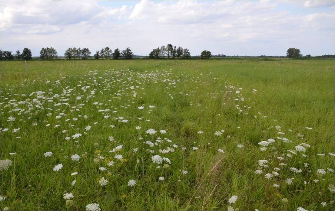
In midsummer 2012, the target species strips presented themselves in a Daucus carota aspect. Numerous other target species grew in the lower class. (Photo: Sandra Dullau) 
In spring (beginning of May) 2013, the target species strips reached a degree of coverage between 50 and 80%. After an additional care cut carried out in autumn 2012, they separated from the surrounding stand, which was only mowed in a single channel, without sowing (control variant). (Photo: Henriette John) Establishment of target species in the 1st year after sowing. 93% of the introduced species grew up. Only 2 species could not be recorded.


Examples of species that were also able to develop in the 2nd year on the site.

Knautia arvensis with a strong rosette in spring 2013. (Photo: Sandra Dullau) 
Centaurea jace was one of the most established target species. The species blossomed in the first year after sowing and was the herbaceous target species with the greatest coverage in spring 2013. (Photo: Sandra Dullau) 
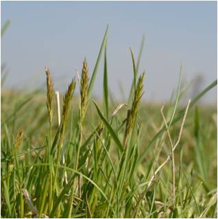
In some cases, Anthoxantum odoratum established itself so strongly that coverage of up to 40% was achieved in spring 2013. (Photo: Sandra Dullau) 
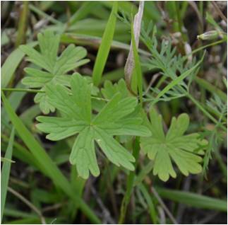
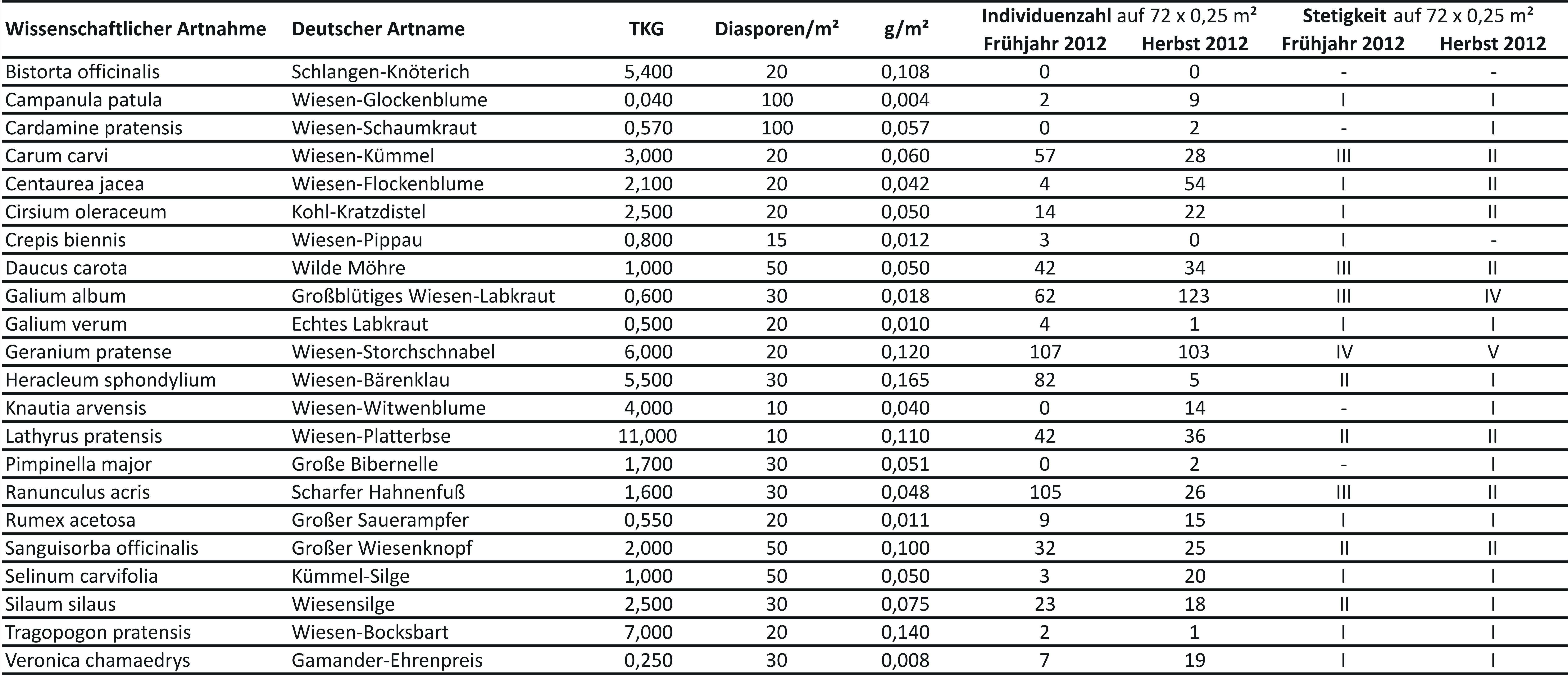
Recording of the sown herbaceous target species in the 1st year after sowing by counting seedlings on 72 test areas of 0.25 m² each In the first year after sowing, the target herbaceous species were counted on 50 x 50 cm (0.25 m²) test areas. Geranium pratense (meadow cranesbill), Ranunculus acris (sharp buttercup) and Galium album (large-flowered meadow bedstraw) have established themselves in particularly large numbers. Some species, such as Knautia arvensis (meadow scabious) and Centaurea jacea (meadow knapweed), did not grow until the summer. It remains to be seen to what extent species that did not appear in the first year after sowing or only appeared in small numbers in the second year. Experience from many other measures for upgrading meadows with few species, however, shows that sown species need up to 3 years to establish.
Meadows in the UNESCO Biosphere Reserve “Karstlandschaft Südharz”
Meadows in the UNESCO Biosphere Reserve “Karstlandschaft Südharz”
In 2010 first site groups for the natural habitat types 6440 (Cnidion floodplain meadows), 6510 (Lowland meadows) and 6520 (Mountain hay meadows) in Saxony-Anhalt are defined and described, and very first management recommendations were verbalized. The description of the characteristic of the site, which includes data of soil properties and vegetation composition was difficult to describe, especially for the habitat type 6510. This natural habitat type is distributed over the whole country of Saxony-Anhalt and there was only very old literature and existing data. A deficit of knowledge particular for the site group 1.3 (bases-rich, moderately fresh sites of the planar-colline height level with poor nutrient availability) shows the priority of the plant community of Dauco carotae-Arrhenatheretum elatioris formed in the subassociation salvietosum pratensis. Hundt (1958) provides only data for this association from the south of Saxony-Anhalt. However, this kind of meadows is found in the area of the Biosphere Reserve "Karstlandschaft Südharz". There is no data about species composition on habitat type mapping (BioLRT data) except on the Special Areas of Conservation „Bundsandstein- und Gipskarstlandschaft bei Questenberg im Südharz“ (FFH0101) and „Gipskarstlandschaft Pölsfeld und Breiter Fleck im Südharz“ (FFH0108). Data on soil properties (especially nutrient levels) and feed value of the crop is not existing. On the one hand, such information is extremely important for the discussion of management recommendations to ensure a favorable conservation status. On the other hand, there is the endeavor of the Biosphere Reserve to conserve sheep grazing and to revive the keeping of old cattle breeds. This allows the use of meadows to gain winter feed or feed supplement for year-round free-range during periods of higher layers of snow. By analyzing the feed value of the crop its suitability as winter feed is assessed.
For the proposed duration of the project a unique sampling of 15-20 meadows per year is provided. In every meadow 1-3 sample plots should be set up depending on the character of the meadow.
The sampling contains:
- mixed soil sample on a plot of 10 m x 10 m (early spring)
- notation of vegetation properties on 5 m x 5 m (in May/June)
- crop sample on 1 m x 1 m (in May/June)

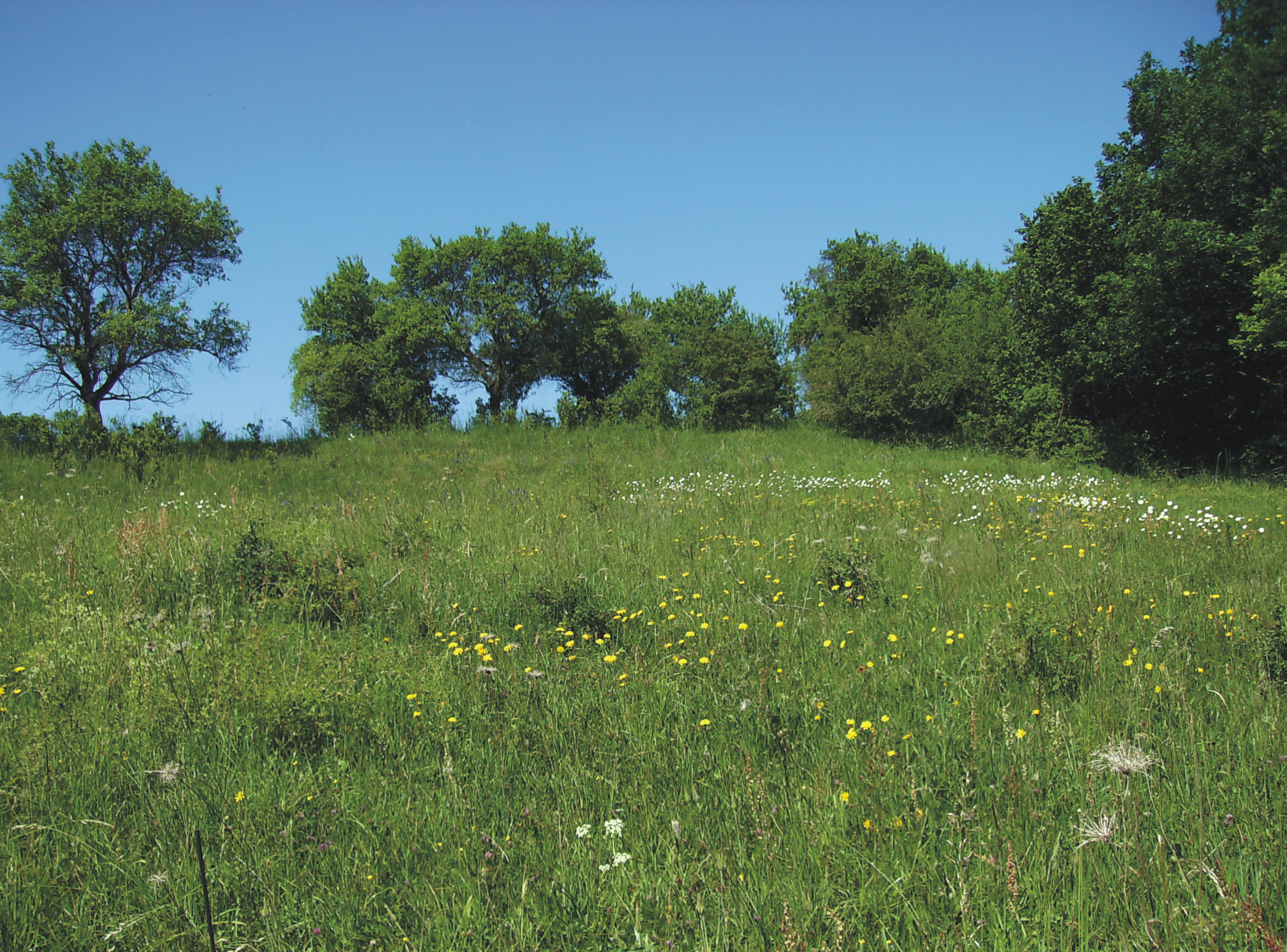
Flowering hay meadow (LRT 6510) in the Biosphere Reserve „Karstlandschaft Südharz“. (photo: Anika Scholz) 
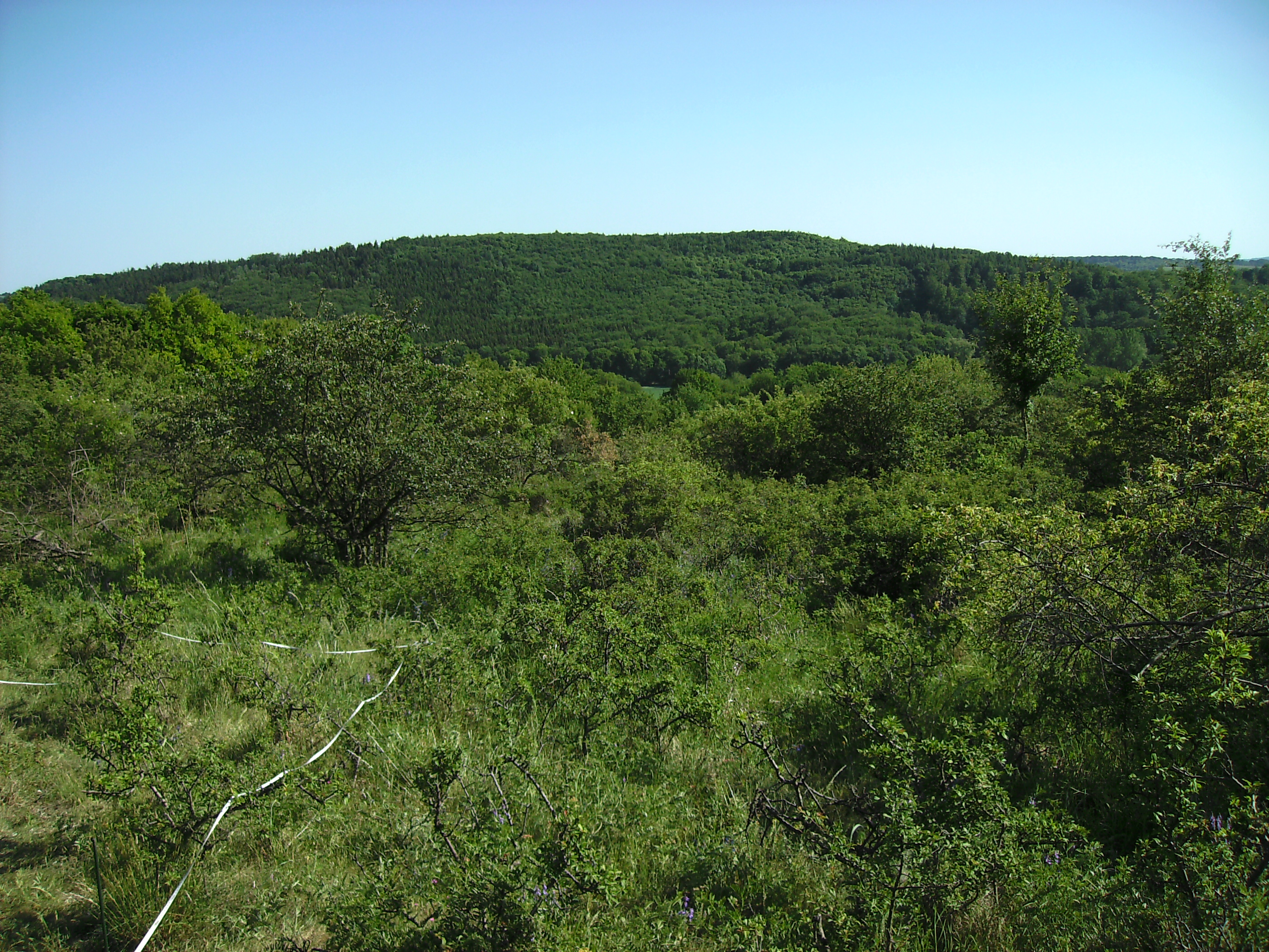
Shrub-infested hay meadow with Prunus spinosa near Hainrode. (photo: Anika Scholz) First results available!
As part of a master's thesis at the Anhalt University of Applied Sciences, the test results of 38 test areas of the Flandland hay meadows (LRT 6510) in the Karst Biosphere Reserve in the Southern Harz Mountains were evaluated.
You can download this master thesis by Katrin Henning here.
Grassland evaluation
Grassland evaluation
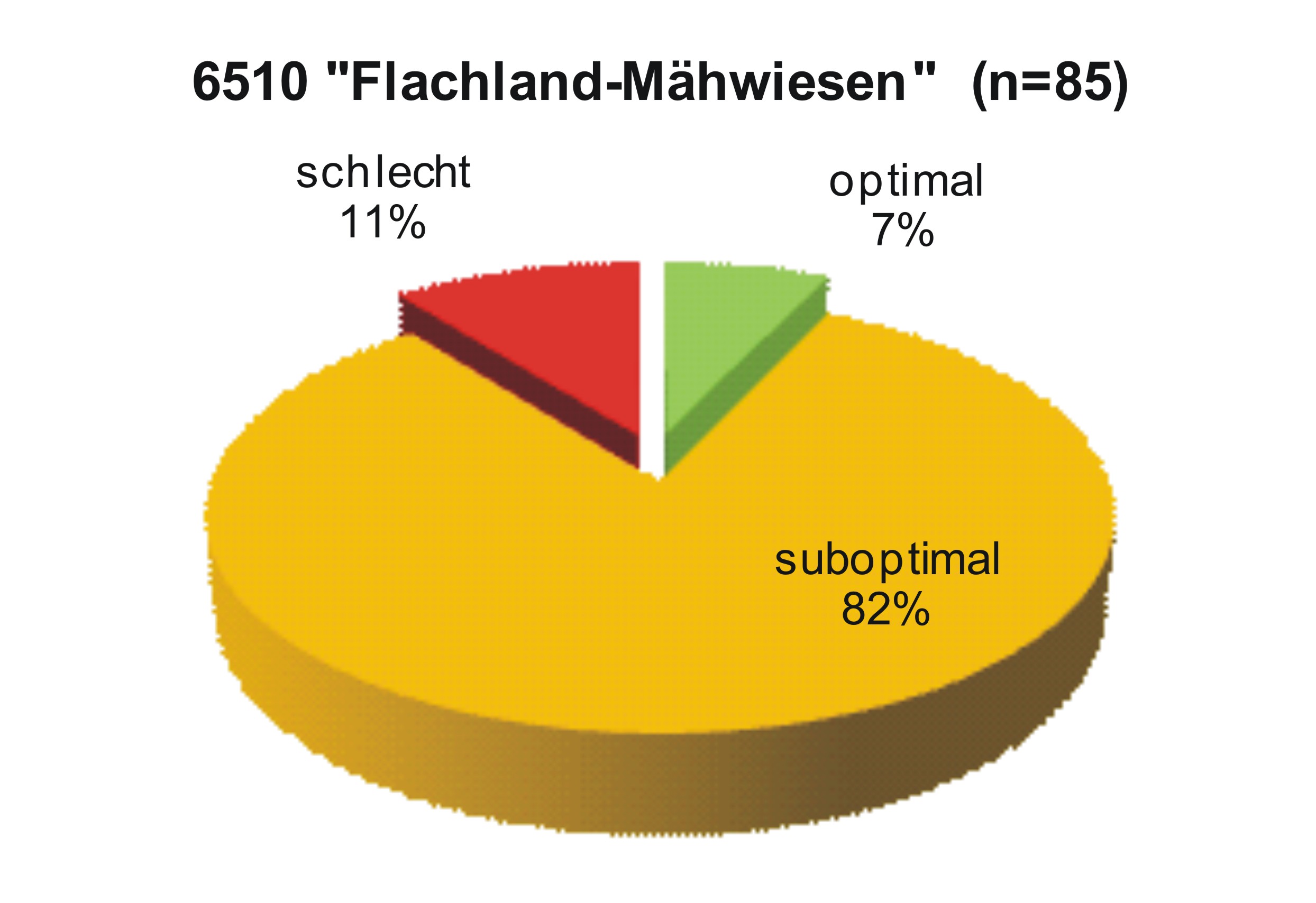
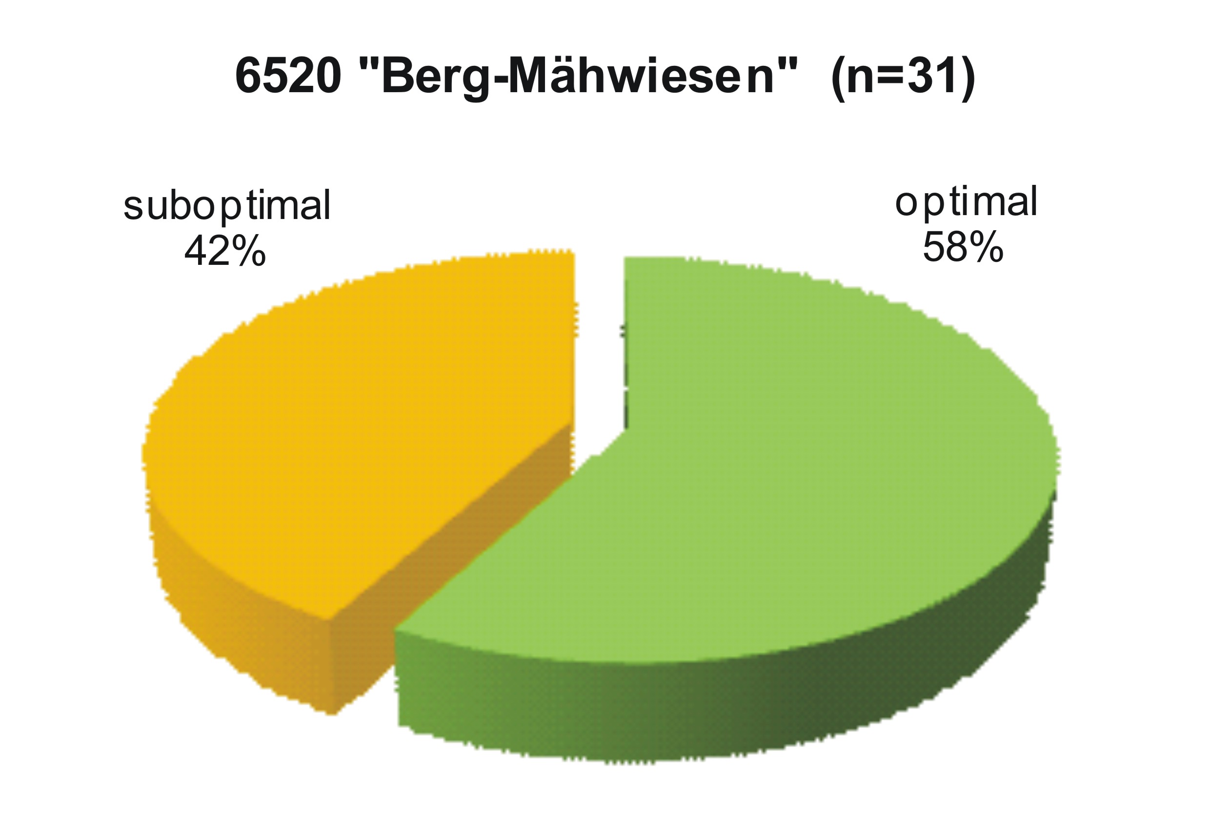
In the evaluation of grassland areas of habitat types 6210 (dry lime lawns), 6440 (Brenndolden-Auenwiesen), 6510 (lean flatland meadows) and 6520 (mountain-hay meadows) in Saxony-Anhalt, selected, well-documented measures that are part of the Program Voluntary Nature Conservation Services (RdErl. Of the MLU from January 24th, 2008 - 55.60129 / 4.4.2) or within the scope of contractual nature conservation (RdErl. Of the MRLU from April 11th, 2002 - 55.3-60129 / 4.4.2, amended by RdErl. Of the MLU from April 10, 2003 - 55-3-60129 / 4.4.2) are evaluated. Between 2010 and 2012, 179 areas were recorded in eleven districts of Saxony-Anhalt, and in 2013 up to 40 more grasslands in the north are to be examined and assessed.
In the evaluation of grassland areas of habitat types 6210 (dry lime lawns), 6440 (Brenndolden-Auenwiesen), 6510 (lean flatland meadows) and 6520 (mountain-hay meadows) in Saxony-Anhalt, selected, well-documented measures that are part of the Program Voluntary Nature Conservation Services (RdErl. Of the MLU from January 24th, 2008 - 55.60129 / 4.4.2) or within the scope of contractual nature conservation (RdErl. Of the MRLU from April 11th, 2002 - 55.3-60129 / 4.4.2, amended by RdErl. Of the MLU from April 10, 2003 - 55-3-60129 / 4.4.2) are evaluated. Between 2010 and 2012, 179 areas were recorded in eleven districts of Saxony-Anhalt, and in 2013 up to 40 more grasslands in the north are to be examined and assessed.
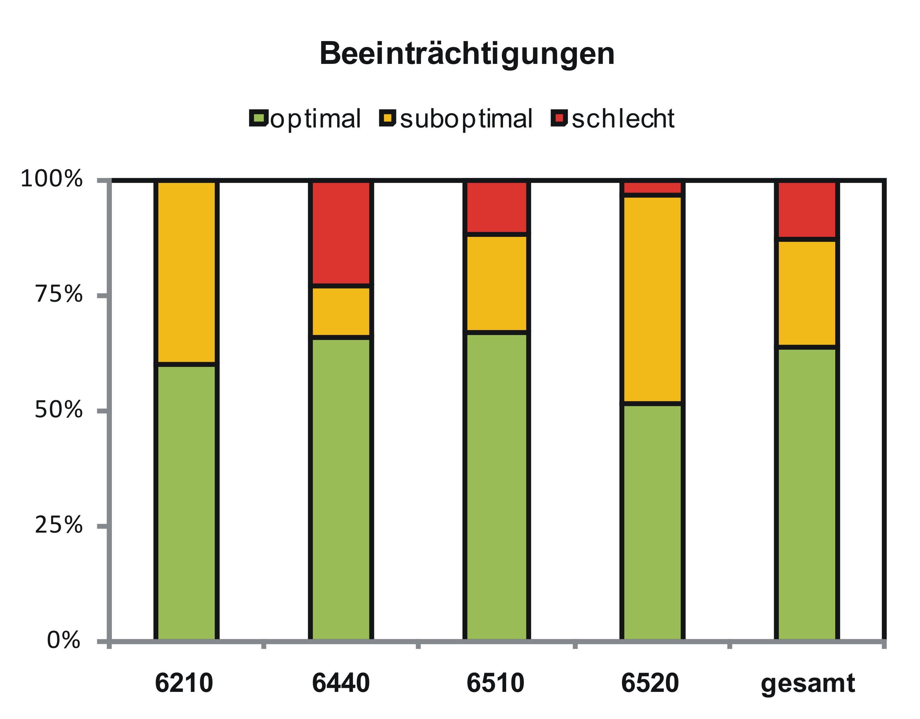
The recording of the vegetation of the grassland areas is based on the evaluation of grasslands of the cultural landscape program (KULAP) in Thuringia. The species-specific percentage of yield is estimated for all of the higher plants in a field block. The assessment is also based on the cultural landscape program (KULAP) of Thuringia (Hochberg et al. 2003). The list of valuable grassland species used there has been modified for Saxony-Anhalt. A target / actual comparison is made to assess the status. The proportion of valuable grassland species, the habitat structure (proportion of herbs, stratification) and impairments are considered.
The evaluation results allow statements about the current state of the grassland of the LRT 6210, 6440, 6510 and 6520 in Saxony-Anhalt under agri-environmental measures. Statements about the effectiveness of measures of the programs Voluntary Nature Conservation Services and Contractual Nature Conservation can hardly be made, since a repeat recording is pending.
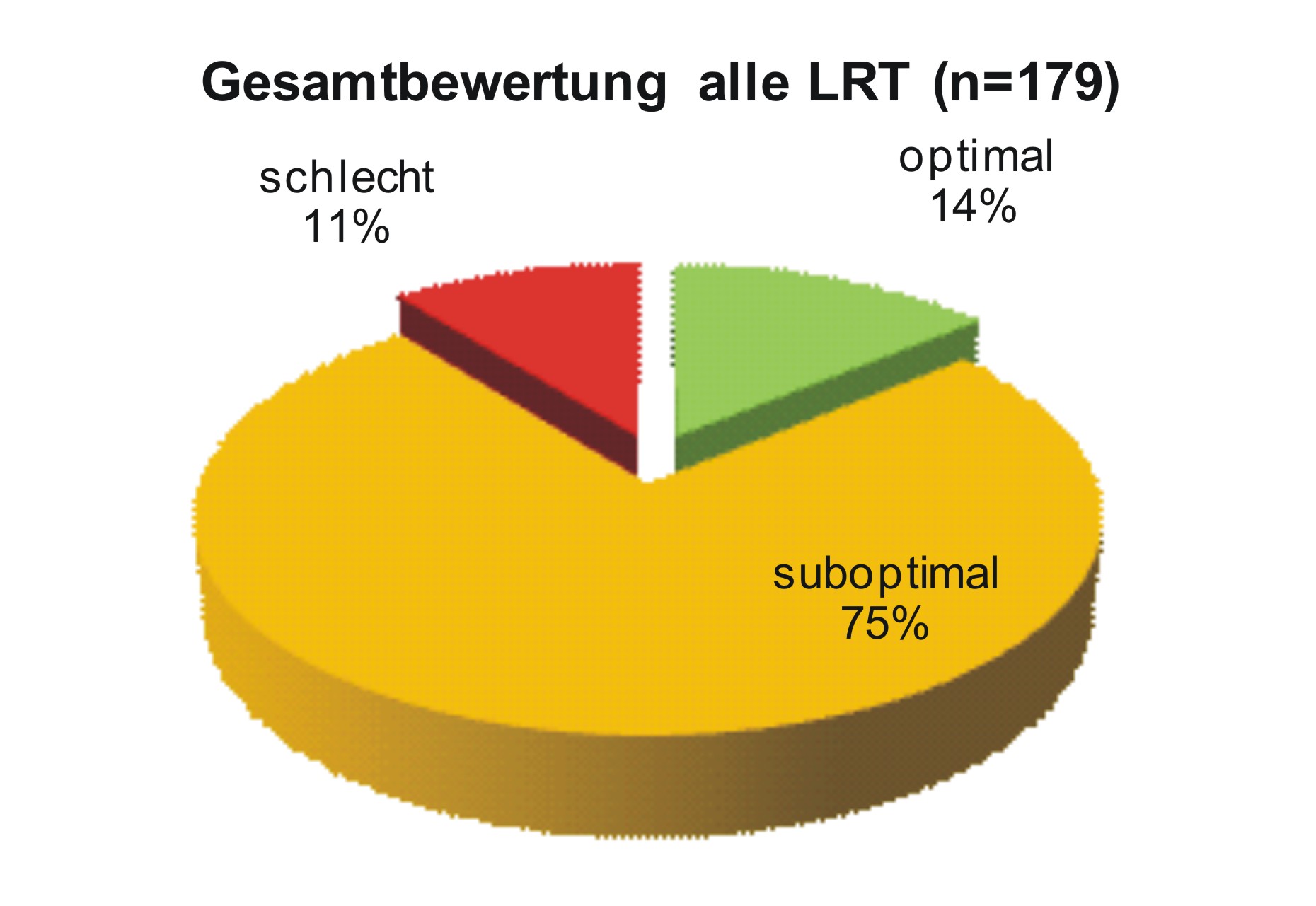
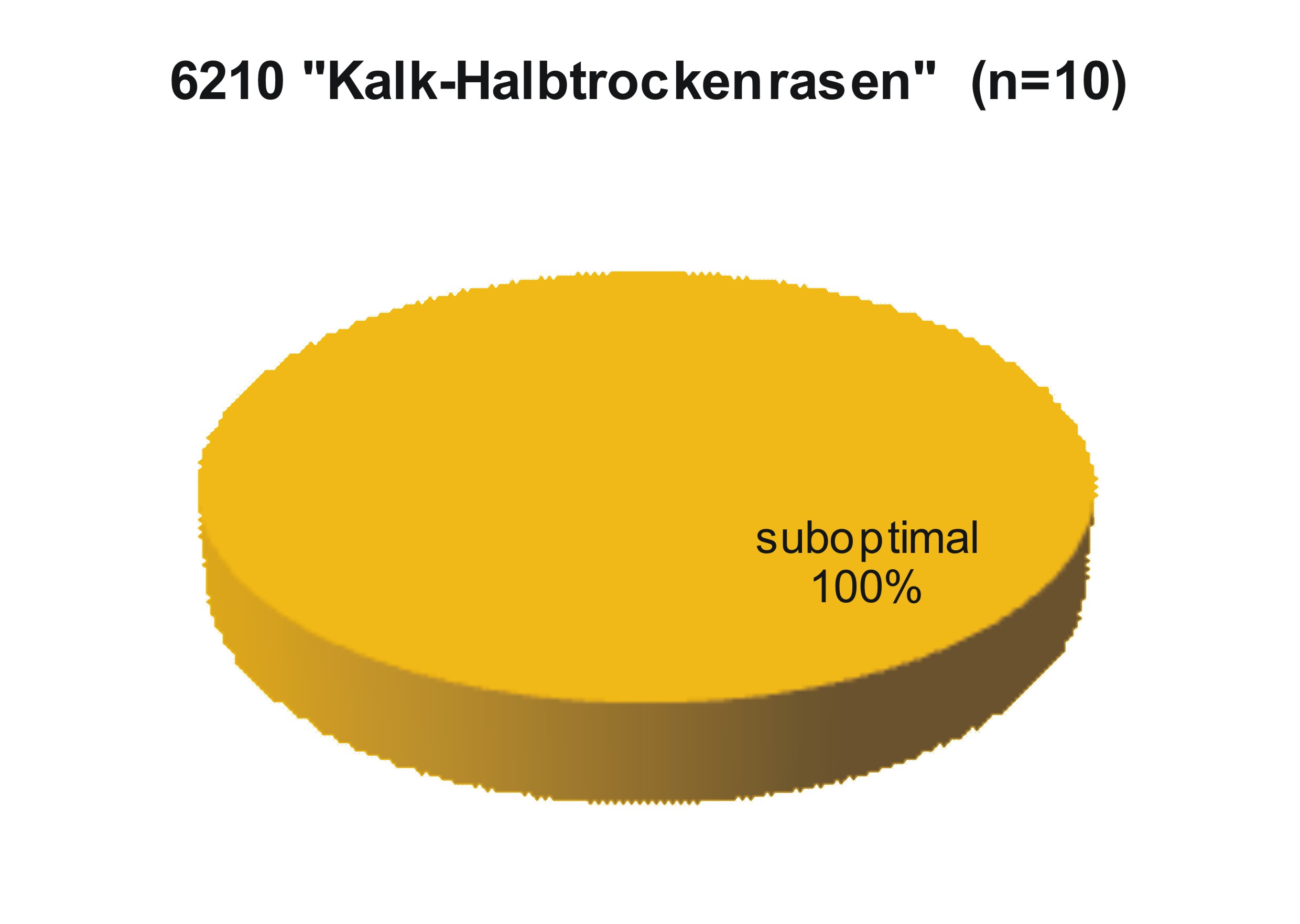
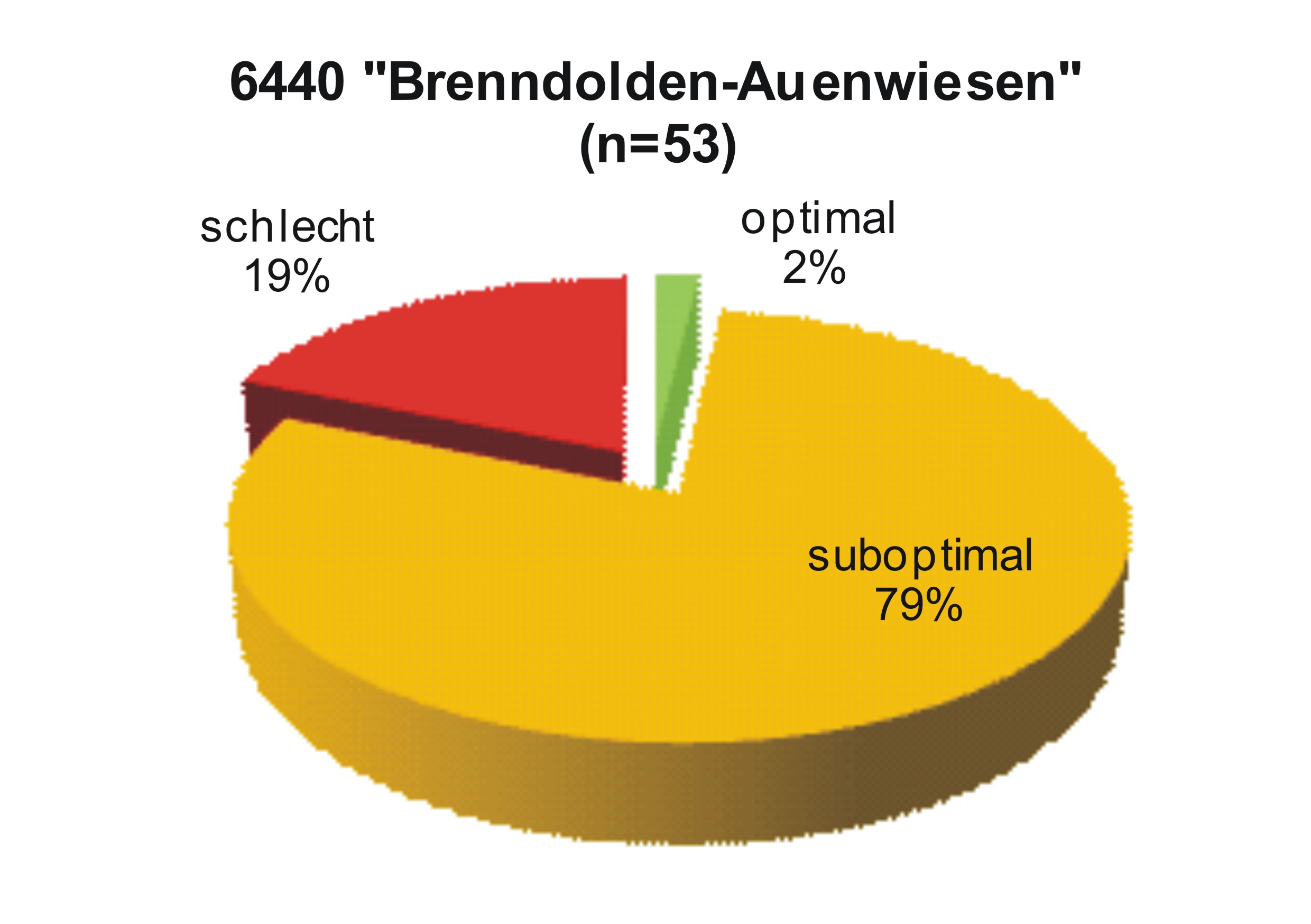
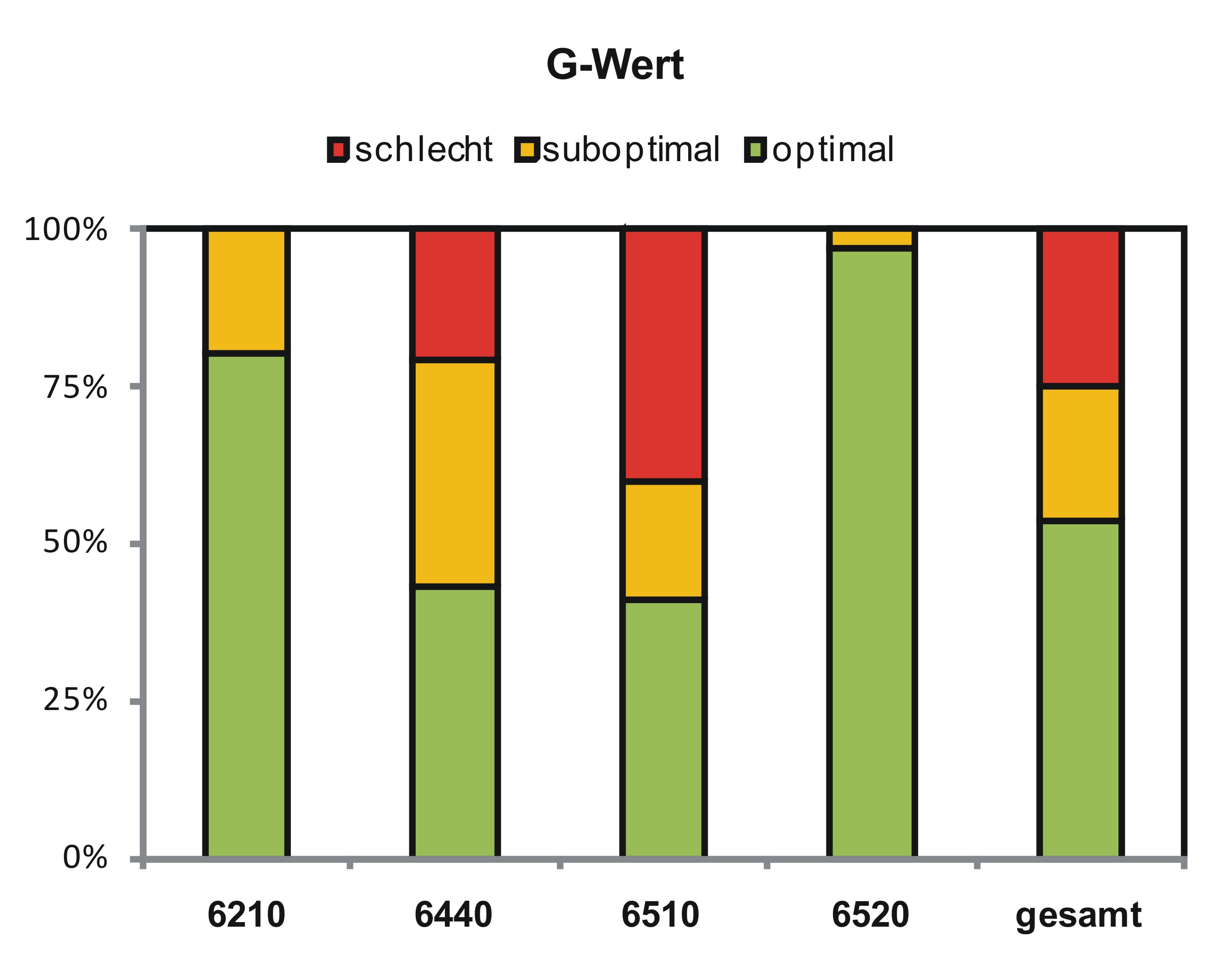
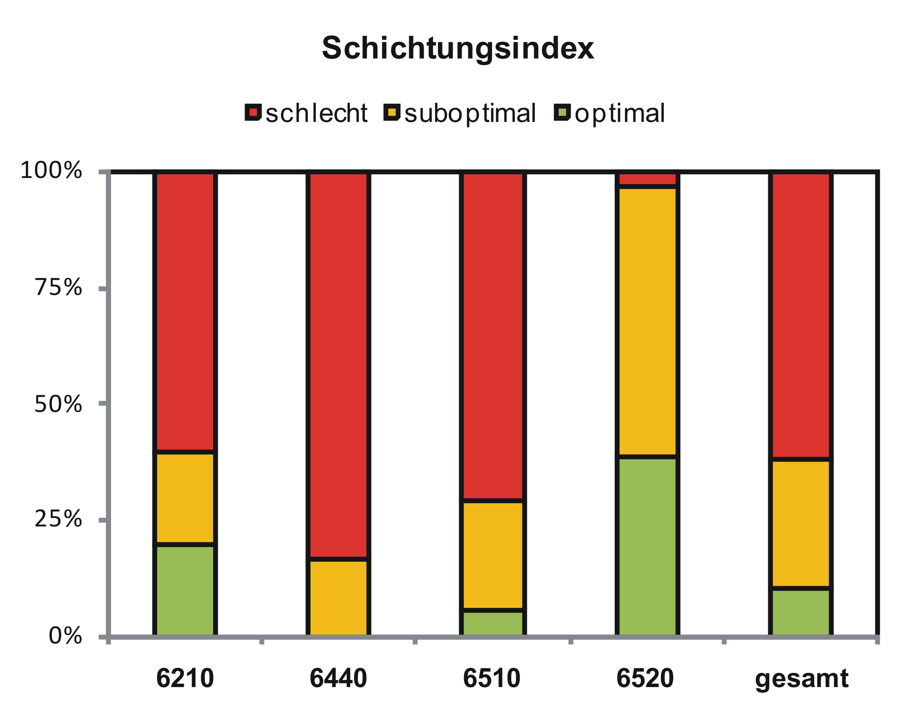
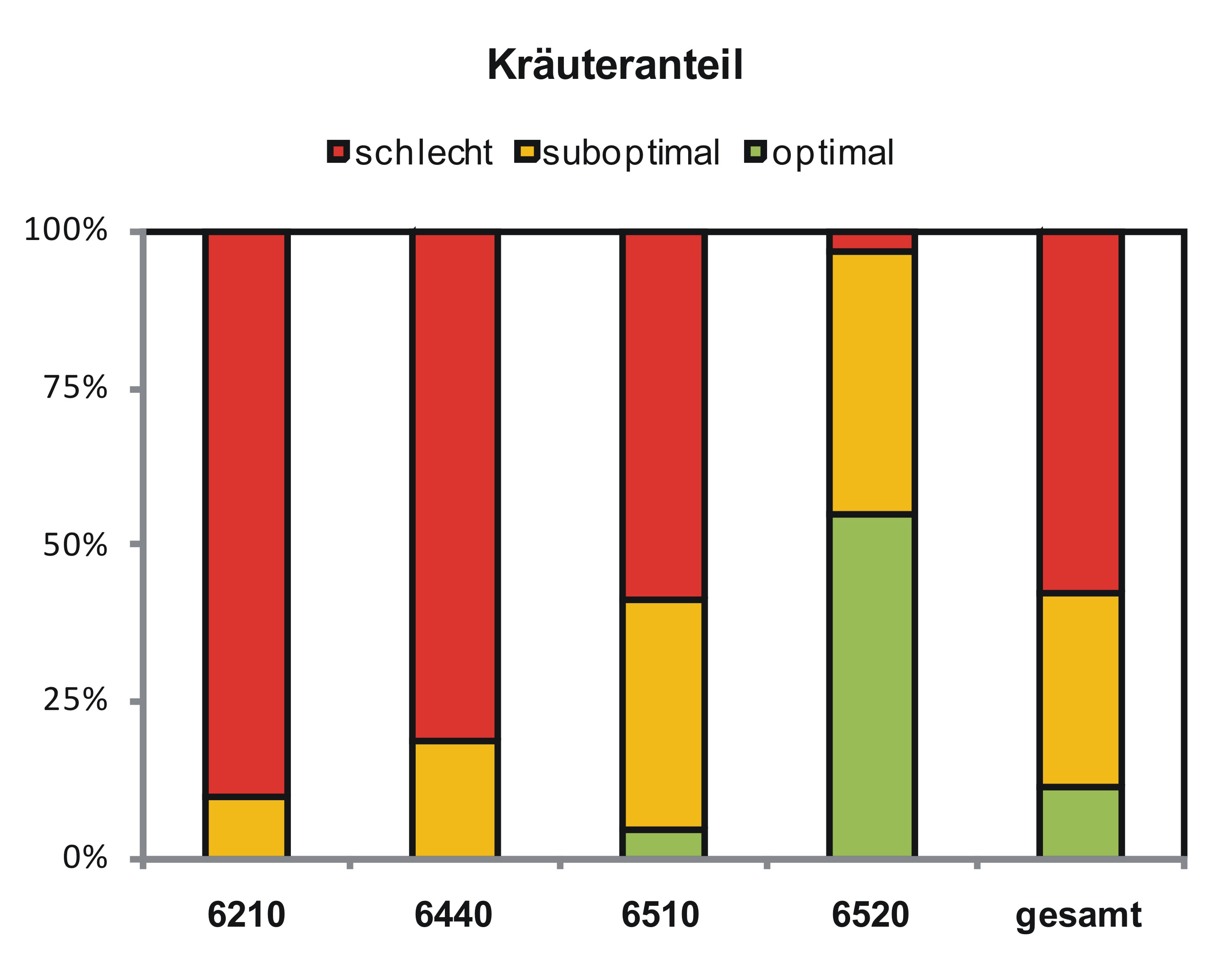
The evaluation showed that the grassland very often shows suboptimal conditions. The greatest problem is the high proportion of grass and the tendency to be single-layered. As a rule, this is the result of insufficient frequency of use. In the case of high-yield locations in particular, management within the FNL or the VNS may be too low. This means that very well developed stocks cannot be preserved or poorly developed stocks cannot be further developed (cf. Bossard 2000, Hölzel 2003). When comparing the evaluated measures with the management recommendations of the Saxony-Anhalt location groups according to Dullau et al. (2010) showed that the measures are not suitable for preserving meadows that are valuable in terms of nature conservation or leading them there, since they do not represent the optimal management for the habitat types. Often a single use is specified, but many location groups of the evaluated habitat types should be used twice or sometimes three times a year. The voluntary nature conservation services aim to secure and improve the condition and diversity of biodiversity (MUL 2008) and should therefore be based on the optimal management recommendations (cf. Dullau et al. 2010). The results of the evaluation so far suggest that the extensive farming method supported by the Voluntary Nature Conservation Services program does not have a beneficial effect on the species composition and population structure of the productive grasslands of LRT 6440 and 6510.
Overall assessment for lifelong dream types 6210, 6440, 6510 and 6520 (n = 179) in the data collection period 2010-2012.


Evaluation of the sub-indicators for the Habitat types 6210, 6440, 6510 and 6520 (n = 179) in the recording period 2010-2012.


Nutrient status of the evaluated grassland

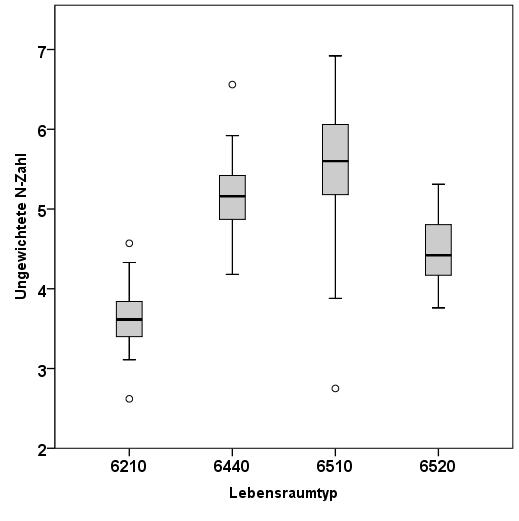
In order to illustrate the nutrient situation of the evaluated grasslands, unweighted nitrogen numbers (Ellenberg et al. 1992) were calculated on the basis of the plant species found. The figure below shows that the values of all areas are between 7 (showing nitrogen richness) and 2 (showing extreme nitrogen to nitrogen poverty). When looking at the box plot, it can be seen that the lean lowland hay meadows (LRT 6510) showed the largest range. Most areas of this habitat type (> 81%) had an N number> 5, 26% in the range between 6 and 7, but some areas also had an average weighted nitrogen number of 2. These nutrient-poor areas can be attributed to the drier forms of the LRT 6510. The majority of the burnt-cone floodplain meadows (LRT 6440) are also rich in nutrients. Here the lowest values are> 4 and 62% of the examined areas had an N number> 5. The mountain hay meadows (LRT 6520) recorded significantly poorer nutrients. The lime dry grasslands (LRT 6210) in southern Saxony-Anhalt had the lowest N numbers. The mean weighted nitrogen number there was mostly in the range of 3.
Conclusion and outlook
The results of the evaluation so far suggest that the extensive farming method supported by the "Voluntary Nature Conservation Services" program does not have a beneficial effect on the species composition and population structure of the productive grasslands of LRT 6440 and 6510. With its large number of location groups, the LRT 6510 in particular has a wide range of mean N numbers (Figure 5). There is a connection between the mean N number and the G value (R² 0.576) and the overall rating (R² 0.353). With an increasingly better supply of nutrients, the nature conservation value decreases with extensive use. A differentiated orientation of the funding programs would therefore be absolutely desirable. For productive grasslands, from a floristic point of view, two-tier use with an early mowing date should be possible.
The investigations on subsidized grassland areas in the state of Saxony-Anhalt will be continued until 2013 as part of the project.
The current results of the grassland evaluation will be published in the next issue of Pulsatilla (11).
Project leader: Prof. Dr. habil. Sabine Tischew
Researchers: Dipl.-Ing. (FH) Sandra Dullau, Dr. Henriette John, M. Sc. Jessica J. Arland-Kommraus
Funding: ELER Sachsen-Anhalt, Förderperiode 2007 – 2013, Landesverwaltungsamt Sachsen-Anhalt
Duration: 04/2010 - 09/2011 (FKZ: 407.1.9-60128/323010000010), 10/2011 - 09/2013 (FKZ: 407.1.9-60128/323011000033)
Cooperation partners: Landwirtschaftsgesellschaft Dessau-Mildensee mbH, Agrargesellschaft Wulfen mbH, Biosphärenreservat Mittelelbe, Biosphärenreservat Südharz


